Project:
TNC - Indonesia, East Kalimantan Province
84

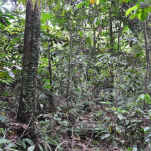
Land cover type: Lightly degraded forest
Notes:Part of a watershed protection area
Altitude : 78
Slope : 5
Concession : TRH
CuttingBlock : ConservationZone
RecorderFacing : SW
Audio Recordings
This site contains recordings from Mon, 8th Aug 2016 at 05:56 (+00:00).
This site covers and there are recordings for 1 day and 37 seconds of that time.