Project:
TNC - Indonesia, East Kalimantan Province
14

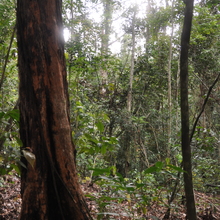
Land cover type: Twice logged
Notes:Close to a river and a skid trail
Altitude : 247
Slope : 10
Concession : GGA
CuttingBlock : 2015
RecorderFacing : NW
Audio Recordings
This site contains recordings from Mon, 25th Jul 2016 at 08:05 (+00:00).
This site covers and there are recordings for 1 day, 18.0 hours, 41.0 minutes, and 52 seconds of that time.